

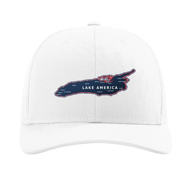
The name change is now reflected on the most widely used map in the country. This is a plain account of what happened and in what order.
What changed
In late August the President signed an executive order renaming Lake Ontario to Lake America. The U.S. Geographic Names Information System (GNIS) — the federal database that holds the official name of every geographic feature in the country — was updated to match.
On August 29, Google published a note explaining how it would handle the update. Its stated practice is to follow official government sources, and GNIS is the source it uses for the United States. The change began rolling out to Google Maps on August 30, 2026.
What you see depends on where you are
The label is not the same everywhere, and that is deliberate:
- In the United States — Lake America
- In Canada — Lake Ontario
- Everywhere else — both names, shown together
This is Google's standing approach for a body of water that carries more than one official name depending on which government you ask. Canada has not adopted the new name, so on the Canadian side of the lake the old one still stands. The water did not move. The label did, in one of the two countries that share it.
The map hat
We made the U.S. edition.
The patch is a custom contour cut — no circle, no shield, no border. The die follows the lake's own shoreline, taken from public-domain federal survey data, so the outline is the real one down to the bays at the eastern end. Fourteen coastal cities are marked and named: Hamilton, Oakville, Toronto, Oshawa, Cobourg, Trenton, Belleville, Picton and Kingston along the north shore; St. Catharines, Rochester, Sodus Point, Oswego and Sackets Harbor along the south.
The lettering is the part worth mentioning. City names at this size are finer than embroidery thread will hold, which is why maps like this usually get simplified down to a blank shape. SolidCore Embroidery™ holds them — it looks and feels like stitched work but keeps detail and color that thread cannot.

It comes as the Lake America Map Trucker Hat in five Richardson 112 colorways plus one Infinity Charlie ponytail-opening cap in dusty rose.
Shop the Lake America Map Trucker Hat →
For the record
Whatever anyone makes of the decision, it is now on the map — and a map is a document. The Lake America Map Trucker Hat is the version of that document you can wear, designed and made in Avon Lake, Ohio, just west of Cleveland.










Share:
Marshall Canyon's Bear Family Made It Out — and Onto a Hat
Cleveland's Lantern Nights and Port Clinton's Walleye Weekend